Reimagining the Pacifica Pier
through Science, Art and Community.
Recent damage has created an important opportunity — not simply to rebuild the pier, but to reimagine what it can become.
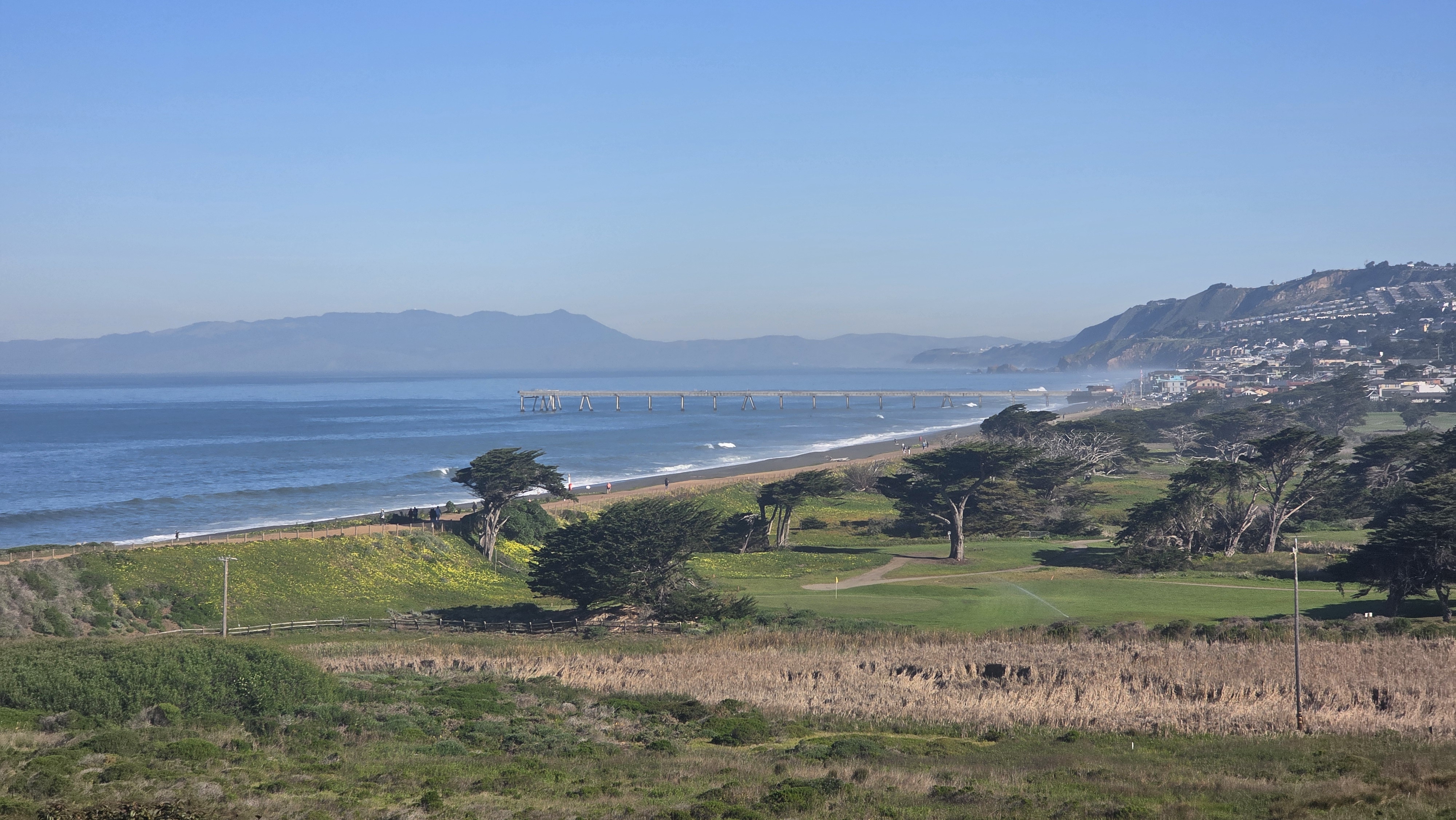
Aerial photo: Chris Baldwin
Why the Pier
Why the Pacifica Pier Matters.
Recent damage has created an important opportunity: not simply to rebuild the pier, but to reimagine what it can become. The Pacifica Coastal Observatory exists to transform this beloved landmark into a living instrument of civic science, public art, and community storytelling — equipped, for the first time, to observe, measure, and communicate what surrounds it.
For generations, the Pacifica Pier has been the defining landmark of our community. It is where children catch their first crab, families gather to watch the sunset, and visitors experience the power of the Pacific Ocean up close. More than just a structure, it is our civic front porch — a shared space where residents connect with nature, witness migrating whales, and gather together through every changing season.
But the pier is more than a destination. It is a place where Pacifica can truly observe itself. Standing dynamically between land and ocean, it reminds us that our coast is not static — every day brings new tides, new wildlife, and a living conversation between people, nature, and time. The pier sits at the threshold of one of the most data-rich coastal environments on the California coast, where gray whales, humpbacks, and blue whales pass within sight of its railings, and kelp forests and intertidal communities respond in real time to the shifting chemistry of our nearshore waters.
"Every generation inherits a different coastline than the one before it."
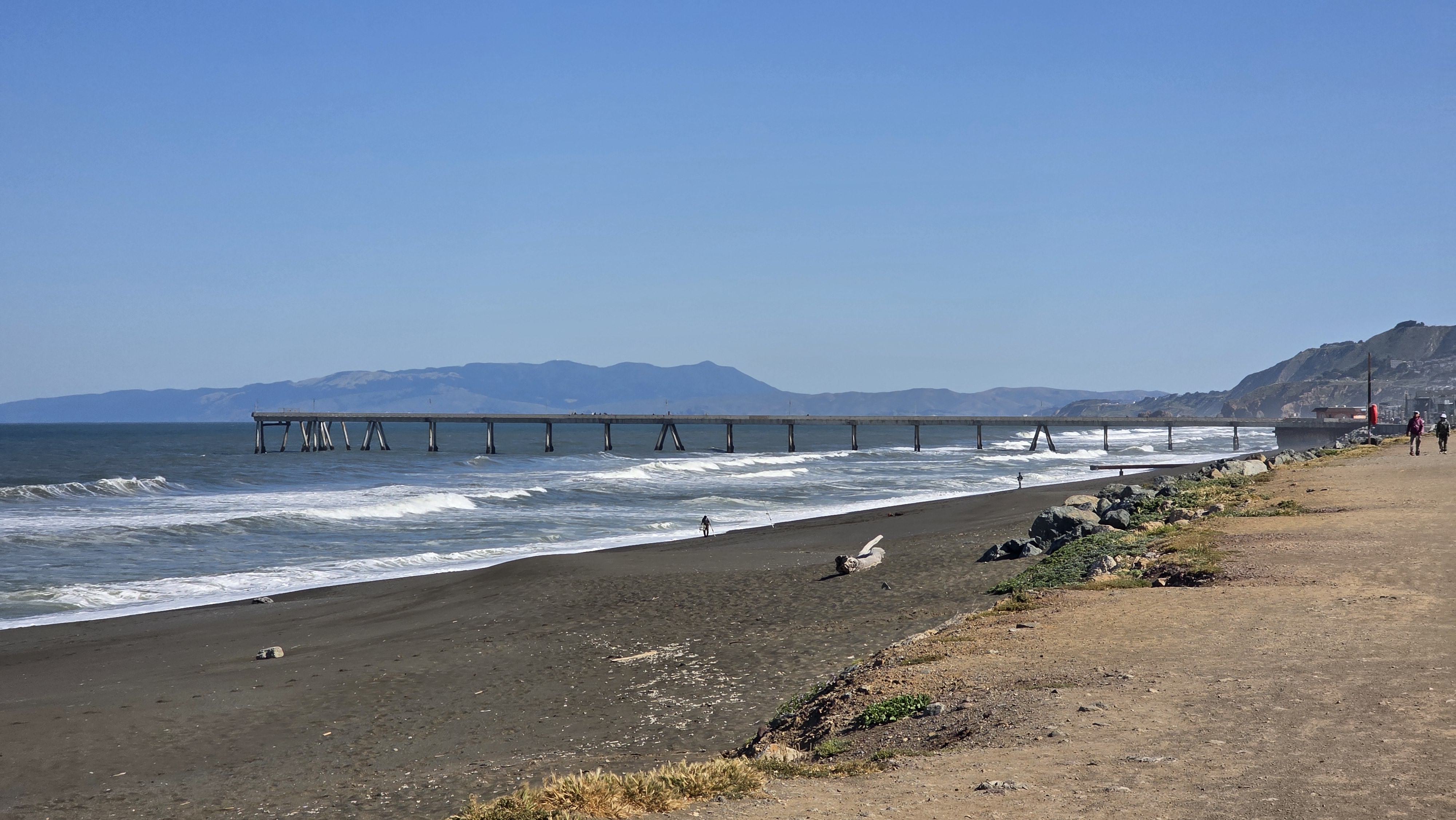
Photo: Chris Baldwin
The Vision
A New Kind of Civic Landmark
Pacifica stands at the meeting point of powerful natural forces and a vibrant human community — yet most of these coastal systems remain unseen until they become problems, or disappear entirely. What if the pier could help make those invisible relationships visible?
The Pacifica Coastal Observatory is a unified vision for a rebuilt pier that honors its past while expanding its utility for future generations. It ensures the structure remains a premier destination for recreation, while seamlessly integrating roles as a living instrument for coastal research, accessible public science, experiential education, and community art. We are building not a project, but an institution — one with the scientific rigor, civic roots, and cultural depth to serve this coastline for a century.
The PCO is structured around three interlocking programs — The Civic Interface, The Luminous Echo, and Our Shared Horizon — each designed to translate the same raw coastal data into a different register: scientific understanding, public art, and community narrative. Together, they form a complete civic instrument for the Pacifica coast.
"The pier is not just infrastructure. It is a threshold — between the city and the sea, between what we know and what we are only beginning to understand."
Scientific Rigor
Peer-reviewed methodology, open data standards, and partnerships with leading research institutions.
Civic Roots
Community governance, local partnerships, and a commitment to making data accessible to every resident.
Cultural Depth
Art, storytelling, and oral history as essential instruments of environmental understanding.
Long-Term Thinking
Institutional design built to serve the coastline for 100 years, not 100 days.
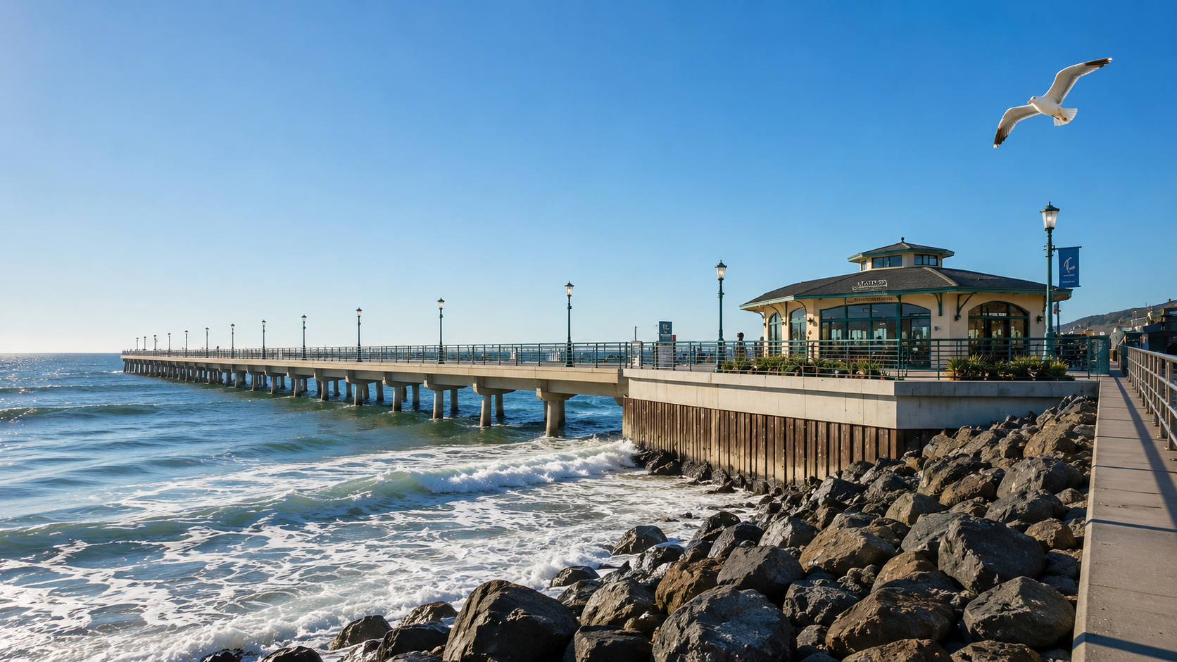
Original photo: Chris Baldwin · AI-reimagined pier visualization
The Pacifica Coastal Observatory
Three Programs. One Coastline.
The Civic Interface
World into Data
Deploying nearshore hydrodynamic sensors, BioHealth sondes, and cetacean telemetry systems to de-risk coastal resilience and protect our coast.
The Luminous Echo
Data into Visual Art
A dynamic public beacon translating raw oceanographic forces and whale presence into generative light installations along Beach Boulevard and the pier.
Learn more →Our Shared Horizon
Data, Art, & Spirit
A civic platform and archive for community poetry, oral histories, music, and youth mentorship anchored to our changing coastline.
Submit your voice →A Program of the Pacifica Coastal Observatory
The Civic Interface
World into Data
Our sensor network will include nearshore hydrodynamic instruments measuring wave energy, current velocity, and water temperature; BioHealth sondes monitoring dissolved oxygen, pH, salinity, and chlorophyll; and future integration with regional cetacean tracking networks and passive acoustic monitoring platforms to visualize local whale presence and seasonal migration patterns.
All data collected by the PCO Civic Interface will be made freely available to researchers, educators, municipal planners, and the public through our open data portal. We believe that coastal data belongs to the community that lives with the coast. Our job is to bring the relevant data to a single place and to make it legible to not only the widest number of people, but also critical to the most influential decisions we will face in the future.
The telemetry dashboard below shows illustrative data representing the type of real-time information the Civic Interface will provide.
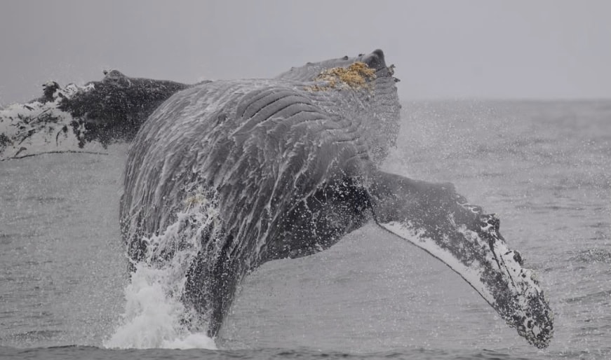
Photo credit: Chris Campo
"This Civic Interface demonstrates how real-time oceanographic and ecological data will be presented to the Pacifica community. We are actively collaborating with local schools and research partners to transform complex coastal datasets into immersive, interactive educational tools for classrooms, community science, and municipal planning."
PREVIEW DRAFT — Telemetry displays and data integrations are currently in staging pending formal partner accords.
Our Local Whale Sightings
Civic Science Demo · Illustrative DataSighting Density · Pacifica Nearshore Zones
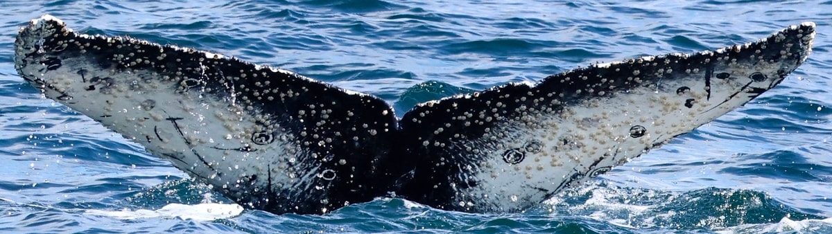
Photo credit: Chris Campo
Most Sighted Individual · YTD
Secret Smiley
Humpback Whale · #PCO-2026-01
Interface concept designed to display regional cetacean telemetry and coastal oceanography. Displayed metrics and numbers are representative placeholders for demonstration purposes only. Built for future integration with regional research platforms, local observer networks, and educational institutions.
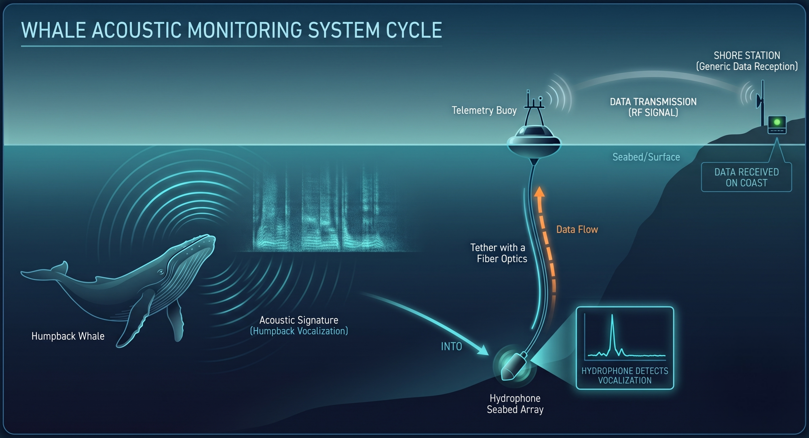
Low-frequency whale calls detected by bottom-mounted hydrophones, transmitted to NOAA's Passive Acoustic Cetacean Map (PACM).
IllustrativeSpecies Detected · Central CA Shelf · PACM 2023
% of monitored days with confirmed acoustic detections · SWFSC shelf stations
Passive Acoustic Cetacean Map (PACM). 2026. Woods Hole (MA): NOAA NEFSC v1.3.4. Data represent offshore shelf detections; nearshore presence inferred from surfacing records. PCO nearshore hydrophone deployment will provide hyper-local acoustic coverage.
Interface concept designed to display regional cetacean telemetry and coastal oceanography. Displayed metrics and numbers are representative placeholders for demonstration purposes only. Built for future integration with regional research platforms, local observer networks, and educational institutions.
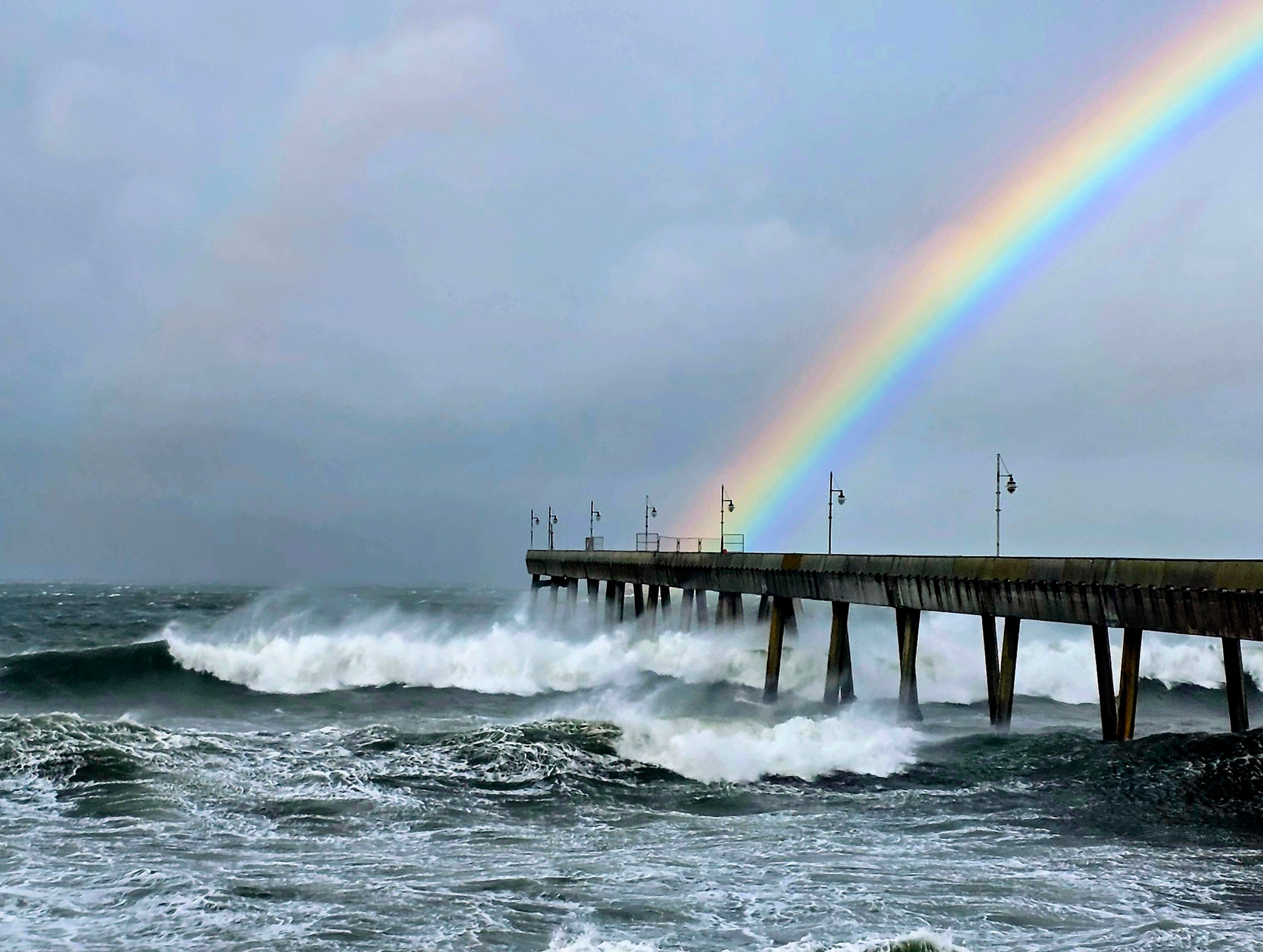
Photo: Chris Baldwin
Wave Energy Index
NOAA Buoy 46026 · Updated HourlySignificant Wave Height
Dominant Swell Period: 14.5s WNW (285°)
Nearshore Wave Power Density
Source: NOAA National Data Buoy Center · Buoy 46026 (San Francisco, 37.759°N 122.833°W) · Wave power density derived from significant wave height (Hs) and dominant period (Tp). U.S. Government data — public domain (17 U.S.C. § 105).
Beach Sand Retention · Three Zones · Pier as Dividing Line
2026–2027 Seasonal Coastal Outlook
NOAA Climate Prediction Center & USGS CoSMoS Predictive Model
ENSO Status
Strengthening El Niño
SST Anomaly +1.8°C Trend
Projected Winter Swell Shift
+35% Frequency
High-energy events (Hs > 4.5 m)
Modeled Intertidal Sand Drawdown
−6 ft to −10 ft
Beach Blvd Corridor
Risk Factor
Elevated
Winter storm-surge toe scour along armored zones
Predictive oceanography models combine NOAA buoy telemetry with USGS CoSMoS storm-surge downscaling to forecast seasonal shoreline impact.
Model forecast issued July 2026. Projections carry inherent climate variability; intended for scenario modeling only.
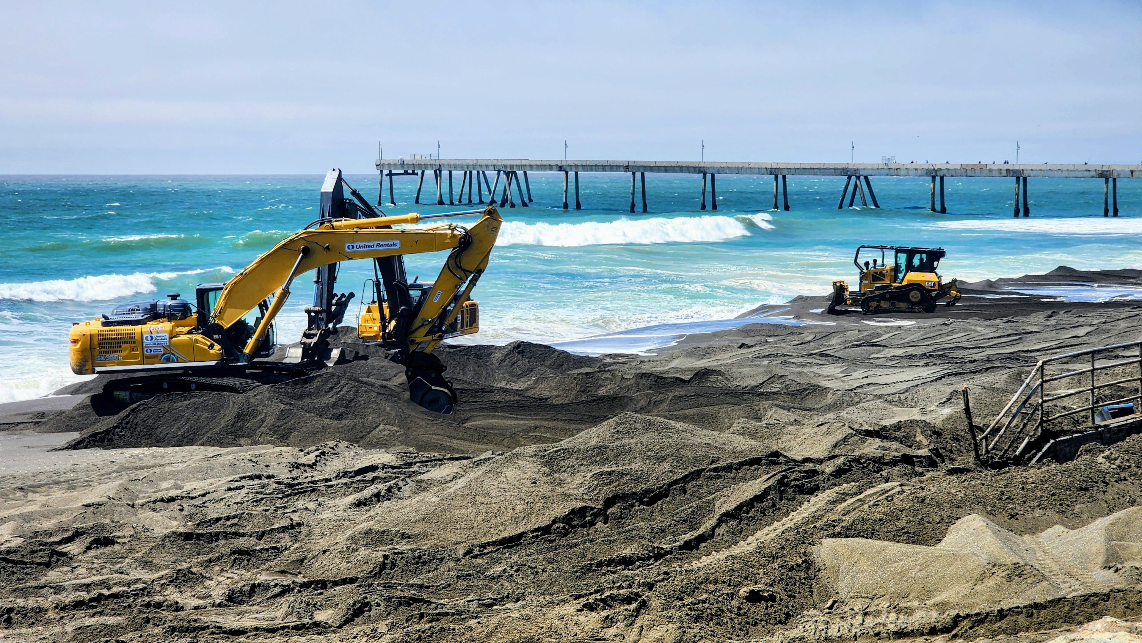
Photo: Chris Baldwin
Linda Mar Beach
Natural Beach · No Seawall
Avg Beach Width
200–350 ft
Annual Net Change
±0.1–0.3 ft
San Pedro Creek sediment feed + natural dune system. Seasonal variation only.
South of Pier
Sharp Park · to Mori Point
Avg Beach Width
40–80 ft
Annual Scour
0.5–1.2 ft/yr
Seawall-backed; moderate scour. Mori Point headland provides partial southern shelter.
North of Pier
Beach Blvd Armored Zone
Avg Beach Width
0–30 ft
Annual Scour
>2.5 ft/yr
Reflective wave dynamics; high energy transfer during winter swell cycles. Nearshore buffer optimization reduces toe scour along seawall foundations.
Sources: NOAA Climate Prediction Center (CPC) · USGS CoSMoS (Central California) · US Army Corps of Engineers (Sec 204 Study) · City of Pacifica Resiliency Plan · Sharp Park Beach Management Plan · NOAA Office for Coastal Management
NOAA Buoy Station 46026 (San Francisco) operated by the National Data Buoy Center (ndbc.noaa.gov). PCO correlates wave power density with coastal erosion and reef attenuation models.
Data shown is illustrative, representing the format and type of information the live Civic Interface will provide.
.png)
Conceptual imagery only — the final artistic design has not been determined
A Program of the Pacifica Coastal Observatory
The Luminous Echo
Coming Soon
"Transforming observation into experience — helping a community see, feel, and remember the life of its coast."
The full reconstruction of the Pacifica Pier will take years — but the conversation about its future must begin right now. We do not intend to wait while this temporary devastation fades into a distant memory.
An Open Invitation
We are actively seeking collaborators to help shape this vision.
Scientists & Researchers
Bring your data, your models, your fieldwork. We offer a public platform to make your coastal research visible and meaningful to the community.
Artists & Designers
Help us define what this installation becomes. We are looking for bold creative voices to shape the aesthetic language of the Luminous Echo.
Technologists & Engineers
From sensor networks to real-time data visualization, there is deep technical work to be done. Join us in building the infrastructure.
Whether you're a scientist, artist, or simply a neighbor who loves this coast — sign up and be part of what comes next.
The Ground Floor
The Collaboration Platform
The Founder
Chris Baldwin
Founder & Executive Director
For more than 26 years, Chris Baldwin has operated at the vital intersection of high technology, environmental science, and human narrative. As a veteran documentary filmmaker, cinematographer, and founder of Shoulder High Productions, Sustainability Media, and Conveyance Media, Chris has spent his career translating complex global systems into deeply human stories.
His work has served the anchors of the San Francisco Bay Area and Silicon Valley — collaborating with institutions like the California Academy of Sciences to document biodiversity from Madagascar and Venezuela to the High Sierras, and serving Stanford Hospital and Lucile Packard Children's Hospital with a career-long dedication to honor and compassion. His corporate and media portfolio includes organizing complex, highly technical productions for leaders such as Cisco Systems, HPE, CrowdStrike, Intel, PG&E, and Bloomberg TV.
Crucially, Chris has spent the last 20 years collaborating with the Long Now Foundation to document their Seminars for Long-Term Thinking and the 10,000-Year Clock (a project funded by Jeff Bezos). This deep immersion in multi-generational engineering and institutional foresight heavily informs his approach to local environmental challenges. Having studied Wildlife Management and Socio-Economic Development with the School for Field Studies in Kenya, and having traveled the globe — including an intensive three-month journey documenting the world's top educators for the Global Teacher Prize — Chris brings a profoundly global perspective home to the California coast.
As a dedicated Pacifica resident, Chris founded the Pacifica Coastal Observatory to apply a lifetime of technological literacy, team leadership, and long-term thinking to his immediate shoreline. By bridging macro-oceanographic data streams with grassroots civic science, he is dedicated to transforming the changing realities of our coastal infrastructure into a transparent, inspiring, and actionable narrative for the community he calls home.
How You Can Help
The Pacifica Coastal Observatory is built on a model of radical collaboration. We are opening formal invitations across five critical development pillars:
As we finalize our fiscal sponsorship arrangements and begin fundraising, we are not posting job listings — we are looking for mission-aligned collaborators who want to get in on the ground floor and make their impact on the shape of things to come.
Technical Working Group
Data Scientists, Software Architects, and AI engineers to build our civic interface, sensor pipelines, and the Luminous Echo algorithms.
Experiential Curriculum
Science Educators and curriculum designers who translate raw scientific phenomena into immersive learning for local schools and public installations.
Institutional Alliances
Community groups, environmental organizations, and advocacy leaders who align with our pillars of localized action and environmental transparency.
Strategic Growth & Council
Technical Grant Writers and senior mentors in climatology, civic infrastructure, and municipal development to shape our long-term strategy.
CSR & Tech Infrastructure
Corporate Social Responsibility foundations and tech enterprises to co-design our edge-to-cloud infrastructure and advanced AI data pipelines.
Interested in shaping the horizon? Whether you're an engineer, an educator, or simply a neighbor who loves this coast — we invite you to connect.
Initiate a Collaboration InquiryCommunity Signup
Join the Mailing List
Civic Connections
Stay Informed on the Pacifica Pier
As part of our commitment to coastal transparency and public awareness, the Pacifica Coastal Observatory supports direct community connections to local coastal infrastructure. Sign up to receive official updates regarding pier maintenance and city projects straight from the City Manager.
Sign Up for Official City Pier Updates